Rockefeller State Park Preserve was established in 1983, when the Rockefeller family donated a portion of their Pocantico Hills estate. The preserve is criss-crossed by a network of carriage roads, constructed by the Rockefellers in the 1920s and 1930s, and this hike follows these delightful gravel roads. It traverses the lesser-used western portion of the preserve and follows a portion of the...
Hike Description:
Rockefeller State Park Preserve was established in 1983, when the Rockefeller family donated a portion of their Pocantico Hills estate. The preserve is criss-crossed by a network of carriage roads, constructed by the Rockefellers in the 1920s and 1930s, and this hike follows these delightful gravel roads. It traverses the lesser-used western portion of the preserve and follows a portion of the Old Croton Aqueduct. Because there are many intersecting trails, not all of which are marked with signs, it is strongly advised to take a trail map with you.
You will notice a grassy road just to the west of Gory Brook Road. Proceed north along this road, going around a metal gate with the initials “O.C.A.” You’re now following the route of the Old Croton Aqueduct, built about 1840 to supply New York City with pure water and now a state park. Soon, you’ll pass the Sleepy Hollow Cemetery on the left. In about half a mile, the aqueduct route curves to the left and crosses the Pocantico River on a high embankment. Just beyond, on the left, is a stone structure known as a weir. It contained gates that permitted the aqueduct to be shut off, with the area south of the weir drained for maintenance.
A short distance beyond the weir, you’ll come to a junction, where a dirt road enters from the right. Turn sharply right, leave the route of the aqueduct and enter the Rockefeller State Park Preserve. Almost immediately, you’ll reach a junction and turn right onto the Witch's Spring Trail, which curves to the left and descends gently.
Soon, you’ll reach an H-shaped junction. Here, you should turn sharply right onto the Big Tree Trail -- a carriage road that initially parallels the road that you just walked on, but now heading in the opposite direction. The trail descends to cross the Pocantico River on a stone-faced triple-arch bridge. To the right (west) is the massive embankment on which the Old Croton Aqueduct crosses the river. You just crossed this embankment (which can be difficult to see when the leaves are on the trees) a few minutes ago.
Immediately after crossing the bridge, turn left onto the Pocantico River Trail. You now begin to parallel the river, which is on your left. At the next intersection, turn right. The trail shortcuts a sharp bend in the river, but the river soon reappears on the left.
Just beyond, you’ll cross the abandoned Gory Brook Road (note the old concrete bridge over the river on the left). A short distance beyond, you’ll reach another junction. Here, you should turn left to continue on the Pocantico River Trail, which crosses the river on a bridge. On the other side of the river, the Gory Brook Road Trail continues ahead, but you should turn right to continue on the Pocantico River Trail.
With the river now on the right, the trail passes several grassy meadows. Soon, you’ll come to yet another intersection. Ahead, two bridges lead across the Pocantico River, but you should turn left to continue on the Pocantico River Trail. The trail heads north, with the river still on your right. You will begin to hear the sounds of traffic from the rather lightly used Sleepy Hollow Road, which now parallels the trail on the other side of the river. In a few minutes, you’ll come to a particularly attractive section of the river, where the water tumbles over cascades, and a short side trail leads to a small waterfall. A short distance beyond, you’ll reach a fork where the Eagle Hill Trail leaves to the left. You should take the right fork to continue on the Pocantico River Trail, but just beyond, continue straight ahead as the Old Sleepy Hollow Trail begins on the right.
Soon, the trail crosses under the busy and noisy Route 117, which bisects the park. North of the overpass, the trail parallels this limited-access road for a short distance, but soon moves away from it. Continue ahead at the next intersection, where a side trail goes off to the right. Just beyond, the Pocantico River Trail curves to the left, and it soon ends at a T-intersection with the 13 Bridges Loop.
Turn right and follow the 13 Bridges Loop, which climbs gently, following a winding route. Upon reaching the northeast corner of this section of the park, the trail curves to the left and begins a steady descent on switchbacks, passing through an attractive evergreen forest. At the base of the descent, it turns left and heads south, crossing a branch of Gory Brook and then paralleling the brook.
After a while, you’ll come to the first of 12 bridges over Gory Brook (the 13th bridge is the one on which you crossed the brook at the base of the descent), all crossed in rather quick succession. You’ll again cross under Route 117 and reach a junction with the Gory Brook Road Trail. Follow the Gory Brook Road Trail, which continues straight ahead, for 250 feet, then turn right onto the Witch's Spring Trail, which descends to cross Gory Brook. Just beyond the brook crossing, turn right onto the Spook Rock Trail, which climbs briefly but steeply. At the top, the trail turns sharply left, skirting the rock after which it is named. At the next intersection, continue straight ahead, now following the Big Tree Trail (which also goes off to the right). Proceed ahead at the following intersection, and continue on the Big Tree Trail until you reach the H-intersection that you encountered towards the start of the hike.
Bear left at this intersection and continue ahead on the Big Tree Trail, descending to the Pocantico River (you briefly retrace your steps here). After crossing the triple-arch bridge over the Pocantico River, continue straight ahead. The Big Tree Trail begins to climb, and it soon bears right and ends at the abandoned Gory Brook Road. Continue ahead, proceeding south, and folllow the abandoned Gory Brook Road back to your car. This road directly parallels the aqueduct and runs only a few feet from it, but it offers an experience rather different than the aqueduct route that you followed at the start of the hike.
Publication: Submitted by Daniel Chazin on 08/11/2006

This loop hike follows old carriage roads, with very gentle grades, paralleling attractive streams for most of the way.
41.090604, -73.857391
Westchester Co., NY
6 mi
3 hrs

Hike Checklist:
Whether you are going for a day hike or backpacking overnight, it is good practice to carry what we call The Hiking Essentials. These essentials will help you enjoy your outing more and will provide basic safety gear if needed. There may also be more essentials, depending on the season and your needs.
The Essentials
Hiking Shoes or Boots
Water - Two quarts per person is recommended in every season. Keep in mind that fluid loss is heightened in winter as well as summer. Don't put yourself in the position of having to end your hike early because you have run out of water.
Map - Know where you are and where you are going. Many of our hiking areas feature interconnecting network of trails. Use a waterproof/tear-resistant Tyvek Trail Conference map if available or enclose your map in a Ziplock plastic bag. If you have a mobile device, download Avenza’s free PDF Maps app and grab some GPS-enhanced Trail Conference maps (a backup Tyvek or paper version of the map is good to have just in case your batteries die or you don't have service). Check out some map-reading basics here.
Food - Snacks/lunch will keep you going as you burn energy walking or climbing. Nuts, seeds, and chocolate are favorites on the trail.
Sunscreen and insect repellent
Rain Gear and Extra Clothing - Rain happens. So does cold. Be prepared for changing weather. Avoid cotton--it traps water against your skin and is slow to dry. If you are wearing wet cotton and must return to your starting point, you risk getting chills that may lead to a dangerous hypothermia. Choose synthetic shirts, sweaters and/or vests and dress in layers for easy on and off.
Compass - A simple compass is all you need to orient you and your map to magnetic north.
Light - A flashlight or small, lightweight headlamp will be welcome gear if you find yourself still on the trail when darkness falls. Check the batteries before you start out and have extras in your pack.
First Aid Kit - Keep it simple, compact, and weatherproof. Know how to use the basic components.
Firestarter and Matches - In an emergency, you may need to keep yourself or someone else warm until help arrives. A firestarter (this could be as simple as leftover birthday candles that are kept inside a waterproof container) and matches (again, make sure to keep them in a waterproof container) could save a life.
Knife or Multi-tool - You may need to cut a piece of moleskin to put over a blister, repair a piece of broken equipment, or solve some other unexpected problem.
Emergency Numbers - Know the emergency numbers for the area you're going to and realize that in many locations--especially mountainous ones, your phone will not get reception.
Common Sense - Pay attention to your environment, your energy, and the condition of your companions. Has the weather turned rainy? Is daylight fading? Did you drink all your water? Did your companion fail to bring rain gear? Are you getting tired? Keep in mind that until you turn around you are (typically) only half-way to completing your hike--you must still get back to where you started from! (Exceptions are loop hikes.)
Check the weather forecast before you head out. Know the rules and regulations of the area.
The Leave No Trace Seven Principles
Plan Ahead and Prepare
- Know the regulations and special concerns for the area you'll visit.
- Prepare for extreme weather, hazards, and emergencies.
- Schedule your trip to avoid times of high use.
- Visit in small groups when possible. Consider splitting larger groups into smaller groups.
- Repackage food to minimize waste.
- Use a map and compass to eliminate the use of marking paint, rock cairns or flagging.
Travel and Camp on Durable Surfaces
- Durable surfaces include established trails and campsites, rock, gravel, dry grasses or snow.
- Protect riparian areas by camping at least 200 feet from lakes and streams.
- Good campsites are found, not made. Altering a site is not necessary.
- In popular areas:
- Concentrate use on existing trails and campsites.
- Walk single file in the middle of the trail, even when wet or muddy.
- Keep campsites small. Focus activity in areas where vegetation is absent.
- In pristine areas:
- Disperse use to prevent the creation of campsites and trails.
- Avoid places where impacts are just beginning.
- Pack it in, pack it out. Inspect your campsite and rest areas for trash or spilled foods. Pack out all trash, leftover food and litter.
- Deposit solid human waste in catholes dug 6 to 8 inches deep, at least 200 feet from water, camp and trails. Cover and disguise the cathole when finished.
- Pack out toilet paper and hygiene products.
- To wash yourself or your dishes, carry water 200 feet away from streams or lakes and use small amounts of biodegradable soap. Scatter strained dishwater.
- Preserve the past: examine, but do not touch cultural or historic structures and artifacts.
- Leave rocks, plants and other natural objects as you find them.
- Avoid introducing or transporting non-native species.
- Do not build structures, furniture, or dig trenches.
- Campfires can cause lasting impacts to the backcountry. Use a lightweight stove for cooking and enjoy a candle lantern for light.
- Where fires are permitted, use established fire rings, fire pans, or mound fires.
- Keep fires small. Only use sticks from the ground that can be broken by hand.
- Burn all wood and coals to ash, put out campfires completely, then scatter cool ashes.
- Observe wildlife from a distance. Do not follow or approach them.
- Never feed animals. Feeding wildlife damages their health, alters natural behaviors, and exposes them to predators and other dangers.
- Protect wildlife and your food by storing rations and trash securely.
- Control pets at all times, or leave them at home.
- Avoid wildlife during sensitive times: mating, nesting, raising young, or winter.
Be Considerate of Other Visitors
- Respect other visitors and protect the quality of their experience.
- Be courteous. Yield to other users on the trail.
- Step to the downhill side of the trail when encountering pack stock.
- Take breaks and camp away from trails and other visitors.
- Let nature's sounds prevail. Avoid loud voices and noises.
The Trail Conference is a 2015 Leave No Trace partner.
(c) Leave No Trace Center for Outdoor Ethics: www.LNT.org.
Directions to Trailhead :
Follow US 9 north in the Village of Tarrytown to a complex intersection where US 9 bears left. Do not bear left here; rather, continue straight ahead onto New Broadway (most street signs do not give the name of this street). In 0.2 mile, turn right onto Gory Brook Road, which dead ends at parking near the Old Croton Aqueduct.
TRAIN TRANSPORT :
Although there is no direct public transportation, it is possible to walk to the trailhead from the Metro-North Hudson Line Tarrytown Station. Walk north on Depot Place to Main Street, turn right and head uphill to Route 9 (Broadway). Turn left and walk north to a complex intersection where US 9 bears left. Do not bear left here; rather, continue straight ahead onto New Broadway (most street signs do not give the name of this street). In 0.2 mile, turn right onto Gory Brook Road, which dead ends at parking near the Old Croton Aqueduct.
BUS TRANSPORT :
Not available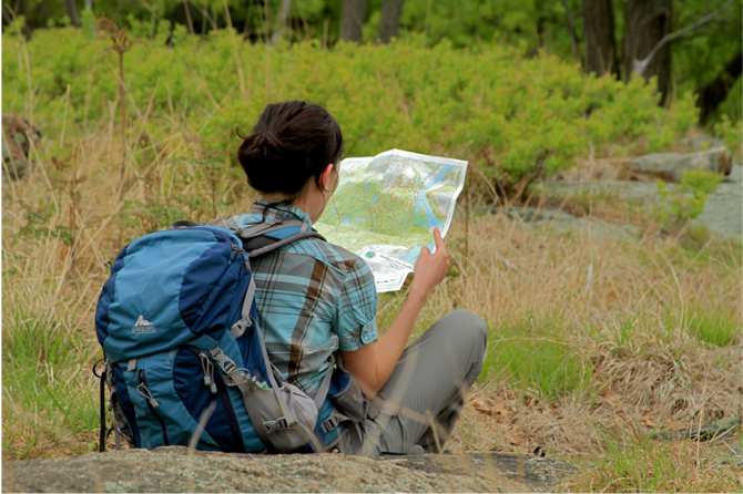
 Give $10 to support trails.
 December 31, 1969
 19:00 pm
Trip Reports
rate experience January 19, 2017
Nice winter hike
I grew up in the area and have hiked Rockefeller State Park Preserve many times. I did the hike you described on January 15, 2017 after a light snowfall and it was quite enjoyable.
If you would like to see some images from this hike, please visit:
https://scenesfromthetrail.com/2017/01/15/pocantico-hills-loop-rockefell...
February 23, 2014
Nice for snowshoeing
Pretty hike with wide carriage roads made for relatively easy snowshoeing. Nice park with lots of walkers. Some photos:
http://agiletrekker.blogspot.com/2014/02/pocantico-hills-loop-walk-rocke...