The Westchester Wilderness Walk might not fit the dictionary definition of “wilderness.” The area is criss-crossed with stone walls, remnants of the early settlements in the area, and houses may occasionally be seen from the trails. But remarkably, for nearly the entire hike, one is entirely removed from the surrounding civilization of Westchester County. The trails have been routed – often,...
Hike Description:
The Westchester Wilderness Walk might not fit the dictionary definition of “wilderness.” The area is criss-crossed with stone walls, remnants of the early settlements in the area, and houses may occasionally be seen from the trails. But remarkably, for nearly the entire hike, one is entirely removed from the surrounding civilization of Westchester County. The trails have been routed – often, quite circuitously – to pass many unusual and interesting natural features, resulting in a hike that will probably seem longer than the map appears to indicate. This preserve was created -- without any public funding – over a period of 20 years by the efforts of Paul Zofnass, a Manhattan investment banker, who arranged for the purchase or donation of various privately-owned parcels.
The trails in the preserve form five loops, four of which will be covered in this hike. They are blazed with green plastic logo markers of the Westchester Land Trust and with blue paint blazes on rocks. Many of the trails are bordered by logs. However, the hiker should be alert for sharp turns, some of which are easily missed, especially if the ground is covered with snow. Note that there are a number of side trails in the preserve that are not marked with the green plastic logo markers and are not included in this hike.
The trail begins at a kiosk just beyond the parking area, where a map of the preserve is posted. It continues along a  woods road, with a wetland on the left, soon passing the start of the West Loop. Continue straight ahead towards the South Loop. A short distance beyond, a sign on the right (behind a deer exclosure) marks the Princess Pine Grove – named for the tiny club moss found in the area. This is the first of a number of named natural features along the trail, many of which are marked by signs.
Soon, the trail narrows to a footpath and crosses several streams on rocks. When you reach a T-intersection, with a wooden bridge on the right, turn left and cross a rock causeway, with a wooden handrail, over a stream. Just beyond, you’ll come to a junction, where the South Loop begins. Turn right and follow the loop in a counter-clockwise direction. Upon reaching Becky’s Brook, the hiker is given the choice of an easier or more difficult route. Just ahead, you'll pass the ruins of Tom’s Cabin. A short distance beyond, you’ll climb rock steps in a narrow passage between two rocks and reach Trudeau’s Point of View.
When you arrive at the South Loop Short Cut, turn right to continue on the main loop. After descending a little, you’ll pass various plaques that recognize the dedicated efforts of the Zofnass family in protecting the preserve. You’ll pass an arboretum on the right and a wetland bordered by well-laid stone walls, then cross a paved private road and go by several more plaques. Just beyond, bear right at a junction to stay on the main trail.
After passing the Lover Trees and crossing a wet area on rocks, the trail climbs a rock stairway to reach Tulip Tree Heights. A short distance beyond, you’ll arrive at Jessica’s Junction, where you should turn right to follow the Roundabout in a counter-clockwise direction. Then, in about a quarter of a mile, you’ll reach another intersection. Here, you should turn right onto the “lollipop stick” of the East Loop.
After a relatively level section, you’ll reach the top of the Grand Stone Staircase. Two routes are provided to descend this interesting feature, with the left route designated as “easier” and the right route “harder.” Neither route is particularly difficult, but you will be returning this way, so you may wish to select the “easier” route for the descent and the “harder” route for the ascent on the return.
After a short descent, you’ll reach an intersection where the East Loop proper begins. Bear right to follow the loop in a counter-clockwise direction. Cross a wet area on large rocks, climb a little, then turn left onto a woods road, with a large wetland on the left and a deer exclosure on the right. When you reach a kiosk and a sign “Out to Upper Shad .1 m,” turn left to continue along the East Loop. At the end of the wetland, you’ll pass a small parking area on the right and reach a paved private road (Joshua Hobby Road). Turn left and follow the road for 250 feet, crossing the outlet of the wetland on the road bridge, then turn left, cross a small stream on a rock bridge, and reenter the woods. This is about the halfway point of the hike. The trail now follows a rather rugged footpath along the northeast shore of the wetland, with several cliffs looming above to the right.
When you reach the end of the loop at the northwest corner of the wetland, turn right. You’re now retracing your steps along the “lollipop stick” of the loop, going back up the Grand Stone Staircase and continuing to the junction with the Roundabout, where you should again turn right.
The trail descends to cross a stream on large rocks. A short distance beyond, it climbs to Over the Top (a rock outcrop to the left of the trail) and descends to Moss Falls, a huge boulder covered with moss. It then climbs to Razor Ridge Rock. After paralleling a stone wall, the trail turns left, making a sharp U-turn, and descends. The trail circles the interesting Roundabout Rock and soon arrives at another junction, where you should turn left. Immediately, you’ll cross a stream on rocks. After briefly paralleling the stream, the trail bears left and begins to head south.
At the next junction, you should turn right at a sign “South Loop – to Kiosk” and go through Wedge Walk Rock, a narrow passage between two boulders. You’ll soon pass the aptly named TV Antenna Rock and descend to a stream. The trail turns right and follows along the stream on large rocks, with the stream directly below (this section of the trail is called the Streambed Steps and is marked with blue paint blazes). After a short distance, the trail turns left and climbs rock steps to the right of a large boulder. It passes Fowler’s Rock and Pauley’s Point Rock and then runs near the edge of an escarpment, with views over a wetland below.
After passing Frannie's View on the left, you'll reach a T-intersection. Turn left at this intersection and descend. Near the base of the descent, one is given the option of taking a longer route around a vernal poind or a shorter, more direct route. A short distance beyond, the trail passes Jurassic Rock and soon begins to run along a wetland. It loops around to cross one end of the wetland on rocks. Then, at the next junction, turn right, but bear left just ahead, where a short side trail to the right leads to a Tulip Poplar Tree. The trail now makes a long loop to the southwest, soon reaching Layer Cake Rock. Be sure to turn left here, as the path straight ahead is a side loop. The main trail goes past Lichen Ledge, Tulip Tree Squeeze and Cantilever Rock. After paralleling a long, slanted rock, it makes a sharp U-turn and begins to descend on switchbacks. Near the base of the descent, it follows stone steps along an attractive cascade and continues on a level path alongside a wetland.
In a short distance, you’ll notice a sign for the West Loop Trail on the right. A portion of the West Loop Trail is currently closed due to flooding caused by beavers, so you should continue ahead on the South Loop, which follows a level path, with a wetland on the right. In a quarter mile, you'll reach a junction where the South Loop begins on the left. Continue ahead (do not turn left) and retrace your steps back to the parking area at the entrance to the preserve, where the hike began.
Publication: Submitted by Daniel Chazin on 12/16/2005 updated/verified on 05/23/2021

This loop hike follows winding paths past interesting natural features through a 150-acre preserve in Pound Ridge, in the heart of Westchester County.
41.175785, -73.599344
Westchester Co., NY
6 mi
4 hrs

Buy Book: Walkable Westchester
Hike Checklist:
Whether you are going for a day hike or backpacking overnight, it is good practice to carry what we call The Hiking Essentials. These essentials will help you enjoy your outing more and will provide basic safety gear if needed. There may also be more essentials, depending on the season and your needs.
The Essentials
Hiking Shoes or Boots
Water - Two quarts per person is recommended in every season. Keep in mind that fluid loss is heightened in winter as well as summer. Don't put yourself in the position of having to end your hike early because you have run out of water.
Map - Know where you are and where you are going. Many of our hiking areas feature interconnecting network of trails. Use a waterproof/tear-resistant Tyvek Trail Conference map if available or enclose your map in a Ziplock plastic bag. If you have a mobile device, download Avenza’s free PDF Maps app and grab some GPS-enhanced Trail Conference maps (a backup Tyvek or paper version of the map is good to have just in case your batteries die or you don't have service). Check out some map-reading basics here.
Food - Snacks/lunch will keep you going as you burn energy walking or climbing. Nuts, seeds, and chocolate are favorites on the trail.
Sunscreen and insect repellent
Rain Gear and Extra Clothing - Rain happens. So does cold. Be prepared for changing weather. Avoid cotton--it traps water against your skin and is slow to dry. If you are wearing wet cotton and must return to your starting point, you risk getting chills that may lead to a dangerous hypothermia. Choose synthetic shirts, sweaters and/or vests and dress in layers for easy on and off.
Compass - A simple compass is all you need to orient you and your map to magnetic north.
Light - A flashlight or small, lightweight headlamp will be welcome gear if you find yourself still on the trail when darkness falls. Check the batteries before you start out and have extras in your pack.
First Aid Kit - Keep it simple, compact, and weatherproof. Know how to use the basic components.
Firestarter and Matches - In an emergency, you may need to keep yourself or someone else warm until help arrives. A firestarter (this could be as simple as leftover birthday candles that are kept inside a waterproof container) and matches (again, make sure to keep them in a waterproof container) could save a life.
Knife or Multi-tool - You may need to cut a piece of moleskin to put over a blister, repair a piece of broken equipment, or solve some other unexpected problem.
Emergency Numbers - Know the emergency numbers for the area you're going to and realize that in many locations--especially mountainous ones, your phone will not get reception.
Common Sense - Pay attention to your environment, your energy, and the condition of your companions. Has the weather turned rainy? Is daylight fading? Did you drink all your water? Did your companion fail to bring rain gear? Are you getting tired? Keep in mind that until you turn around you are (typically) only half-way to completing your hike--you must still get back to where you started from! (Exceptions are loop hikes.)
Check the weather forecast before you head out. Know the rules and regulations of the area.
The Leave No Trace Seven Principles
Plan Ahead and Prepare
- Know the regulations and special concerns for the area you'll visit.
- Prepare for extreme weather, hazards, and emergencies.
- Schedule your trip to avoid times of high use.
- Visit in small groups when possible. Consider splitting larger groups into smaller groups.
- Repackage food to minimize waste.
- Use a map and compass to eliminate the use of marking paint, rock cairns or flagging.
Travel and Camp on Durable Surfaces
- Durable surfaces include established trails and campsites, rock, gravel, dry grasses or snow.
- Protect riparian areas by camping at least 200 feet from lakes and streams.
- Good campsites are found, not made. Altering a site is not necessary.
- In popular areas:
- Concentrate use on existing trails and campsites.
- Walk single file in the middle of the trail, even when wet or muddy.
- Keep campsites small. Focus activity in areas where vegetation is absent.
- In pristine areas:
- Disperse use to prevent the creation of campsites and trails.
- Avoid places where impacts are just beginning.
- Pack it in, pack it out. Inspect your campsite and rest areas for trash or spilled foods. Pack out all trash, leftover food and litter.
- Deposit solid human waste in catholes dug 6 to 8 inches deep, at least 200 feet from water, camp and trails. Cover and disguise the cathole when finished.
- Pack out toilet paper and hygiene products.
- To wash yourself or your dishes, carry water 200 feet away from streams or lakes and use small amounts of biodegradable soap. Scatter strained dishwater.
- Preserve the past: examine, but do not touch cultural or historic structures and artifacts.
- Leave rocks, plants and other natural objects as you find them.
- Avoid introducing or transporting non-native species.
- Do not build structures, furniture, or dig trenches.
- Campfires can cause lasting impacts to the backcountry. Use a lightweight stove for cooking and enjoy a candle lantern for light.
- Where fires are permitted, use established fire rings, fire pans, or mound fires.
- Keep fires small. Only use sticks from the ground that can be broken by hand.
- Burn all wood and coals to ash, put out campfires completely, then scatter cool ashes.
- Observe wildlife from a distance. Do not follow or approach them.
- Never feed animals. Feeding wildlife damages their health, alters natural behaviors, and exposes them to predators and other dangers.
- Protect wildlife and your food by storing rations and trash securely.
- Control pets at all times, or leave them at home.
- Avoid wildlife during sensitive times: mating, nesting, raising young, or winter.
Be Considerate of Other Visitors
- Respect other visitors and protect the quality of their experience.
- Be courteous. Yield to other users on the trail.
- Step to the downhill side of the trail when encountering pack stock.
- Take breaks and camp away from trails and other visitors.
- Let nature's sounds prevail. Avoid loud voices and noises.
The Trail Conference is a 2015 Leave No Trace partner.
(c) Leave No Trace Center for Outdoor Ethics: www.LNT.org.
Directions to Trailhead :
From I-684 take Exit 4 (Mount Kisco/Bedford). Turn east at the bottom of the ramp onto NY 172. At a Shell gas station, turn left and continue to follow NY 172 through the village of Bedford. At a Mobil gas station, turn right onto Long Ridge Road. In 2.5 miles, turn left onto Upper Shad Road and continue for 0.3 mile to a small parking turnout on the left side of the road. The trailhead is marked by a small green sign for the Zofnass Family Preserve.
TRAIN TRANSPORT :
Not availableBUS TRANSPORT :
Not available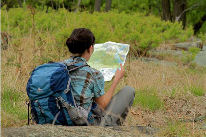
 Give $10 to support trails.
 December 31, 1969
 19:00 pm
Trip Reports
rate experience June 04, 2015
I live in Mt.Kisco and have
I live in Mt.Kisco and have been to Westmoreland, Butler and Mianus River Gorge many times, yet never knew this existed until yesterday. There's something almost magical about this preserve, it has a very Fairy Tale Forest feel. I thought maybe I'd come across a cabin made of candy or a house with 7 dwarves living in it. Either that or it was all laid out by Olmsted. It'seasy to lose your bearings the way all the trails turn on a dime.
I love the story about how Paul Zofnass created the preserve. It's nice to see people doing goodthings with their money. The NY Times had an article explaining how it was done.
May 10, 2015
Nice little park
Nice little preserve with enough trails to do a reasonably long hike. We found this hike very peaceful - very little car noise (only near the trailhead) for such a suburban area. Small parking area - fits around 3, maybe 4 cars.
We found an online map here: http://westchesterlandtrust.org/?page_id=1418
All of the trails use the same green blazes, even though the map shows colored loops. The trail intersections are well marked though (e.g. "Central Roundabout Clockwise", and some intersections even have "you are here" maps.
Some photos:
http://agiletrekker.blogspot.com/2015/05/westchester-wilderness-walk-zofnass.html