This hike traverses the 408-acre Eagle Rock Reservation. The reservation is located in the center of densely populated Essex County, but it is mostly undeveloped and features an extensive trail system. The Olmsted Brothers, who designed Central Park in Manhattan, contributed to the design of the reservation. The footpaths and dirt roads followed by this hike have gentle grades, and the hike is...
Hike Description:
This hike traverses the 408-acre Eagle Rock Reservation. The reservation is located in the center of densely populated Essex County, but it is mostly undeveloped and features an extensive trail system. The Olmsted Brothers, who designed Central Park in Manhattan, contributed to the design of the reservation. The footpaths and dirt roads followed by this hike have gentle grades, and the hike is suitable for novice hikers and families.
From the parking area, proceed ahead to the 9/11 Memorial. This beautiful and inspiring memorial to the tragic events of 9/11/01 is located at a panoramic viewpoint, from where the World Trade Center was visible. It affords a broad view over the New York City skyline, from the George Washington Bridge to the Verrazano-Narro ws Bridge.
After taking some time to enjoy the view and contemplate the memorial, head north, towards the Highlawn Pavilion. Continue ahead under the awning of the pavilion and follow the service road that proceeds northward. At the next intersection, turn right and enter the woods on a footpath at a sign for the Lenape Trail.
The yellow-blazed Lenape Trail follows a wide path along the side of a hill, parallel to Crest Drive on the left. You’ll pass several outcrops of the basalt rock that is characteristic of the Watchung Mountains, on which the reservation is located. (There are three Watchung ranges; Eagle Rock Reservation is part of the First Watchung.) Unlike the New Jersey Highlands, which are made of sedimentary rocks, the Watchungs are composed of igneous rock, formed of intrusions of magma that rose to the surface through cracks in the earth. (The Palisades are formed of a slightly different type of igneous rock known as diabase, which cooled beneath the surface of the ground.)
In about half a mile, you’ll come to a fork, where you should bear left, continuing to follow the yellow blazes. Just beyond, the trail crosses Winding Way, a paved park road, diagonally to the right and continues along a chained-off dirt road, passing Kiosk #2. Here, a triple-blue blaze marks the start of the Blue Trail, and you follow both yellow and blue blazes along the road. Almost immediately, both trails bear right at a fork, and they bear right again at the next fork. At the following fork, where the two trails diverge, bear right to continue on the yellow-blazed Lenape Trail, which climbs to reach a junction with the White Trail (which begins on the left).
Continue along the Lenape Trail, which descends a little, then climbs past large outcrops of the basalt rock characteristic of the Watchung Mountains.Then, after passing a green fence on the right, the trail emerges onto an open area, with a good view of the Lower Manhattan skyline from a rock outcrop at the edge of the escarpment. This spot is known as the North Lookout. The Lenape Trail now bears sharply left and descends. At the base of the descent, the trail crosses a wide park road (the Crest Trail) and continues ahead on another unpaved road.
At the next intersection, with a huge stone residence visible ahead to the right, the Lenape Trail continues straight ahead, but you should turn left onto a dirt road – the route of the red-blazed Walking Trail, which begins here. Soon, you’ll notice the intersection of Afterglow Avenue and Ravine Road on the right. Here, you turn left to continue along the red-blazed Walking Trail, with backyards of homes on the right.
Just past the last home, you’ll reach an intersection with the Blue Trail. Turn right onto the Blue Trail, which follows a wide gravel path, together with the red-blazed Walking Trail. You’ll be following the Blue Trail for the next 1.3 miles.
After crossing a stream on a culvert, you’ll reach a fork. Here, the red-blazed Walking Trail bears right, but you should bear left to continue on the Blue Trail. Soon, you’ll come to a switchback, where the trail makes several sharp bends – first to the right, then to the left – to gain a little elevation. After making a long loop and passing just above the switchback, the trail crosses a grassy road. It then goes around another loop and crosses a dirt road (known as the Broad Wood Trail).
A short distance beyond, the Blue Trail descends, crossing an intermittent stream at the base of the descent. It passes a fenced-in enclosure on the right, crosses a white-blazed dirt road (the Stony Brook Trail) and soon joins another road (the Edgewood Trail), which descends slightly.
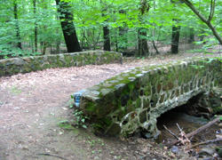 Be alert for a double blaze that marks the point where the Blue Trail turns left on a footpath, leaving the road. Continue to follow the Blue Trail, which soon arrives at another dirt road (the Crosswood Trail). The trail turns left onto the road to cross the Stony Brook on a stone-faced bridge, then immediately bears left onto a footpath, climbing gradually.
After crossing the dirt road, the Blue Trail climbs over exposed basalt outcrops to end at a junction with the yellow-blazed Lenape Trail. Turn left onto a dirt road, now following the yellow blazes, which soon bear right onto another road (the Crosswood Trail).
A short distance ahead, the Lenape Trail reaches a paved park road. The trail turns left to follow the road, but you should cross the road and continue ahead across the lawn to reach the parking area where the hike began.
Publication: Submitted by Daniel Chazin on 07/20/2007 updated/verified on 04/09/2018


This loop hike circles the reservation, following footpaths and unpaved roads, and reaches a panoramic viewpoint over the New York City skyline.
40.803728, -74.237795
Essex Co., NJ
4 mi
2 hrs

Web Map: Eagle Rock Reservation Map
Hike Checklist:
Whether you are going for a day hike or backpacking overnight, it is good practice to carry what we call The Hiking Essentials. These essentials will help you enjoy your outing more and will provide basic safety gear if needed. There may also be more essentials, depending on the season and your needs.
The Essentials
Hiking Shoes or Boots
Water - Two quarts per person is recommended in every season. Keep in mind that fluid loss is heightened in winter as well as summer. Don't put yourself in the position of having to end your hike early because you have run out of water.
Map - Know where you are and where you are going. Many of our hiking areas feature interconnecting network of trails. Use a waterproof/tear-resistant Tyvek Trail Conference map if available or enclose your map in a Ziplock plastic bag. If you have a mobile device, download Avenza’s free PDF Maps app and grab some GPS-enhanced Trail Conference maps (a backup Tyvek or paper version of the map is good to have just in case your batteries die or you don't have service). Check out some map-reading basics here.
Food - Snacks/lunch will keep you going as you burn energy walking or climbing. Nuts, seeds, and chocolate are favorites on the trail.
Sunscreen and insect repellent
Rain Gear and Extra Clothing - Rain happens. So does cold. Be prepared for changing weather. Avoid cotton--it traps water against your skin and is slow to dry. If you are wearing wet cotton and must return to your starting point, you risk getting chills that may lead to a dangerous hypothermia. Choose synthetic shirts, sweaters and/or vests and dress in layers for easy on and off.
Compass - A simple compass is all you need to orient you and your map to magnetic north.
Light - A flashlight or small, lightweight headlamp will be welcome gear if you find yourself still on the trail when darkness falls. Check the batteries before you start out and have extras in your pack.
First Aid Kit - Keep it simple, compact, and weatherproof. Know how to use the basic components.
Firestarter and Matches - In an emergency, you may need to keep yourself or someone else warm until help arrives. A firestarter (this could be as simple as leftover birthday candles that are kept inside a waterproof container) and matches (again, make sure to keep them in a waterproof container) could save a life.
Knife or Multi-tool - You may need to cut a piece of moleskin to put over a blister, repair a piece of broken equipment, or solve some other unexpected problem.
Emergency Numbers - Know the emergency numbers for the area you're going to and realize that in many locations--especially mountainous ones, your phone will not get reception.
Common Sense - Pay attention to your environment, your energy, and the condition of your companions. Has the weather turned rainy? Is daylight fading? Did you drink all your water? Did your companion fail to bring rain gear? Are you getting tired? Keep in mind that until you turn around you are (typically) only half-way to completing your hike--you must still get back to where you started from! (Exceptions are loop hikes.)
Check the weather forecast before you head out. Know the rules and regulations of the area.
The Leave No Trace Seven Principles
Plan Ahead and Prepare
- Know the regulations and special concerns for the area you'll visit.
- Prepare for extreme weather, hazards, and emergencies.
- Schedule your trip to avoid times of high use.
- Visit in small groups when possible. Consider splitting larger groups into smaller groups.
- Repackage food to minimize waste.
- Use a map and compass to eliminate the use of marking paint, rock cairns or flagging.
Travel and Camp on Durable Surfaces
- Durable surfaces include established trails and campsites, rock, gravel, dry grasses or snow.
- Protect riparian areas by camping at least 200 feet from lakes and streams.
- Good campsites are found, not made. Altering a site is not necessary.
- In popular areas:
- Concentrate use on existing trails and campsites.
- Walk single file in the middle of the trail, even when wet or muddy.
- Keep campsites small. Focus activity in areas where vegetation is absent.
- In pristine areas:
- Disperse use to prevent the creation of campsites and trails.
- Avoid places where impacts are just beginning.
- Pack it in, pack it out. Inspect your campsite and rest areas for trash or spilled foods. Pack out all trash, leftover food and litter.
- Deposit solid human waste in catholes dug 6 to 8 inches deep, at least 200 feet from water, camp and trails. Cover and disguise the cathole when finished.
- Pack out toilet paper and hygiene products.
- To wash yourself or your dishes, carry water 200 feet away from streams or lakes and use small amounts of biodegradable soap. Scatter strained dishwater.
- Preserve the past: examine, but do not touch cultural or historic structures and artifacts.
- Leave rocks, plants and other natural objects as you find them.
- Avoid introducing or transporting non-native species.
- Do not build structures, furniture, or dig trenches.
- Campfires can cause lasting impacts to the backcountry. Use a lightweight stove for cooking and enjoy a candle lantern for light.
- Where fires are permitted, use established fire rings, fire pans, or mound fires.
- Keep fires small. Only use sticks from the ground that can be broken by hand.
- Burn all wood and coals to ash, put out campfires completely, then scatter cool ashes.
- Observe wildlife from a distance. Do not follow or approach them.
- Never feed animals. Feeding wildlife damages their health, alters natural behaviors, and exposes them to predators and other dangers.
- Protect wildlife and your food by storing rations and trash securely.
- Control pets at all times, or leave them at home.
- Avoid wildlife during sensitive times: mating, nesting, raising young, or winter.
Be Considerate of Other Visitors
- Respect other visitors and protect the quality of their experience.
- Be courteous. Yield to other users on the trail.
- Step to the downhill side of the trail when encountering pack stock.
- Take breaks and camp away from trails and other visitors.
- Let nature's sounds prevail. Avoid loud voices and noises.
The Trail Conference is a 2015 Leave No Trace partner.
(c) Leave No Trace Center for Outdoor Ethics: www.LNT.org.
Directions to Trailhead :
Take the New Jersey Turnpike to Exit 15W (or take the Garden State Parkway South to Exit 145) and proceed west on I-280. Take Exit 8B and proceed north on Prospect Avenue for 0.3 mile. Turn right at the traffic light onto Eagle Rock Avenue, continue for 0.3 mile, and turn left at the sign for Eagle Rock Reservation. Follow the park access road to the parking area adjacent to the 9/11 Memorial at the Eagle Rock Lookout (if the parking spaces opposite the lookout are full, continue ahead to a nearby parking area).
TRAIN TRANSPORT :
Not availableBUS TRANSPORT :
Not available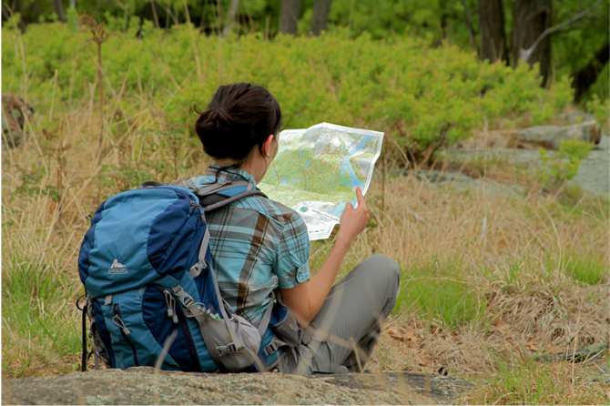
 Give $10 to support trails.
 December 31, 1969
 19:00 pm
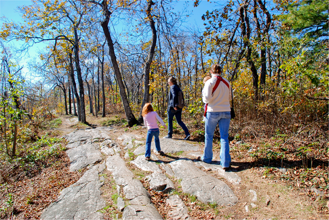
Trip Reports
rate experience November 06, 2014
Great hike until the blue trail
I should never say to myself "wow this trail has so many markers!" because I always jinx myself. The directions above and the trail markers were great until I got to the blue trail. My first confusion was confirming that I was supposed to follow the trail at the last house. I don't know why but that tripped me up (maybe it had to do with the off-leash dog attacking my leashed dog).
Once I started on the blue trail, I had very few problems (one downed tree made me search harder for the further marker) (switchbacks were also fine and clear) until I passed the stone bridge and ended up in a maze of trees where the trail bears left.
I felt so lost that I nearly started to panic (yes an overreaction, I could have just backtracked to the other trails or the street, but I wanted to continue on). In that area of mass trees, the trail is barely clear (at least in October with leaves everywhere) and there are several possible options of similar looking ground. There is no next blue marker in sight for a while. I made 4 wrong starts and needed to backtrack to the blue left turn marker to start over before I finally tredged ahead on the correct trail for a while (after pulling up Google maps and seeing that I would at least be heading towards a road) and I finally found the next blue marker. It was a very exciting moment for me. You may have heard me yell "BLUE!" :)
After that the trail was again obvious with markers on both trees and rocks to help you navigate your way uphill along large flat rocks.
I found the trail to be very clean with not much debris (if you see debris when hiking, how about you pick it up and throw it away!). The trails were rocky and I did turn my ankles a bit but I blame myself because I was only wearing sneakers (that I also used to hike Macchu Picchu) but I didn't have them tied tightly. None of my minor stumbles were enough for me to bother bending down and tying them better, so the rocks must not be that bad!
On a Wednesday morning in October, there were not many people around and it was a peaceful and mostly enjoyable hike.
Also, the views from the 9/11 memorial area are amazing even on an overcast day. They did a very nice job with the memorial. I even saw a big buck hanging out there.
October 15, 2012
Your comments on the trails in Eagle Rock Reservation
I agree that the switchbacks on the blue trail can be a little confusing -- especially since the upper section of the loop nearly touches the lower loop at one point -- but I had no difficulty following the trail when I was there two weeks ago. Also, I am not sure what your complaint is regarding "ID the walking trails with their names to allow orientation." The names of all the trails are shown in the legend box on the Conservancy map.
Regarding your comment on "the horrid condition of the majority of the hiking trails selected," with "stones littering the trails" -- all I can say is that there are stones on virtually all of the hiking trails maintained by the Trail Conference. Hiking trails are not designed to be as smooth as sidewalks, and maintainers are neither required nor encouraged to remove all stones from their trails. Having hiked many trails, I can say that the trails in Eagle Rock Reservation are in no worse condition in this regard than most other trails in the area -- and they may be in better condition that many others. It is always a good idea to wear "sturdy hiking shoes" on any hike, although I should say that when I did this hike two weeks ago, I wore a pair of casual shoes with rubber soles and did not get a sprained ankle.
And, yes, I agree that hike descriptions "should advise of any trail issues that would be dangerous or reduce any pleasure on the hike," but I can only say that, to my knowledge, there are no such special issues that need to be mentioned for this hike. Yes, there are some stones on the trails in Eagle Rock Reservation, but there are stones on every hiking trail, and that is something that every hiker must be alert for on every hike.
October 14, 2012
My wife and I attempted the
My wife and I attempted the hike using the Record newspaper instructions and the conservancy map of Jan 09. Some things stood out from the hike:
1. The directions and the map got us scrambled when we reached the blue-trail switchbacks at the Broadwood Trail. They really should ID the walking trails with their names to allow orientation. We gave up and walked the Crest Trail to the Stony Brook Trail back to Kiosk 2, and then Crest Drive back to the origin.
2. The reason we walked Crest Drive back to the monument was the horrid condition of the majority of the hiking trails selected. There were stones littering the trails and we suggest that anyone who does the hike wear sturdy hiking shoes to prevent any sprained ankles. And we suggest that any future hikes recommended should advise of any trail issues that would be dangerous or reduce any pleasure on the hike.
BTW, I am a NYNJTC member.