From the parking area, turn left and proceed east along paved East Village Road, immediately crossing the Ramapo River. Continue to follow the road as it bears right, paralleling the New York State Thruway, then turns left and crosses under the Thruway. At the next T-intersection, turn left and head north on Grove Drive for about 800 feet. As the road curves to the left, follow the red-dot-on-...
Hike Description:
From the parking area, turn left and proceed east along paved East Village Road, immediately crossing the Ramapo River. Continue to follow the road as it bears right, paralleling the New York State Thruway, then turns left and crosses under the Thruway. At the next T-intersection, turn left and head north on Grove Drive for about 800 feet. As the road curves to the left, follow the red-dot-on-white blazes of the Ramapo-Dunderberg (R-D) Trail, which turn right and enter the woods.
The trail climbs on a switchback and turns left, soon reaching a junction with the yellow-triangle-blazed Triangle Trail, which continues ahead. This trail will be your return route, but you should now turn right and continue on the red-and-white-blazed R-D Trail.
After crossing a grassy woods road, the trail begins a steep climb. At the top of the climb, the trail bears left and soon reaches a panoramic west-facing viewpoint from a rock outcrop to the left of the trail. The village below is Tuxedo, where you began the hike.
The trail now descends briefly, then turns right onto a woods road. A short distance beyond, you’ll reach a junction. The R-D Trail continues ahead, but you should turn right onto the red-dash-on-white-blazed Tuxedo-Mt. Ivy (T-MI) Trail (be careful here, as both trails have red-on-white blazes!). The T-MI Trail climbs on a woods road, crosses a swampy area, and soon arrives at the base of the massive Claudius Smith’s Rock. Claudius Smith, after whom this rock formation is named, was a thief who was reputed to have used the “caves” at its base as a hideout during the Revolutionary War. He was captured by an officer of the Continental Army and hanged at the jail in Goshen in 1779.
When you’re finished exploring the overhanging rock “caves,” continue along the T-MI Trail for a short distance until you reach a junction with the blue-on-white Blue Disc Trail. Turn left and follow the Blue Disc Trail up to the top of this massive rock formation, with its expansive west-facing view. You’ll want to take a break here to enjoy the view!
After taking in the view, retrace your steps to the junction with the T-MI Trail, and turn left, following the red-dash-on-white blazes. The trail descends gradually, making a horseshoe turn at the base of the descent to skirt a swamp to the left of the trail. It then climbs over a low ridge and descends through a rocky area to cross Spring Brook and reach a junction with the White Bar Trail.
Turn left at this junction and follow the White Bar Trail, which runs along a woods road. Soon, you’ll pass the Dutch Doctor Shelter, on a small rise to the right of the trail. Overnight camping is permitted at this and several other similar shelters in Harriman State Park.
A short distance beyond the shelter, you’ll reach another junction. Here, the White Bar Trail curves to the left, but you should continue straight ahead, now following the yellow triangle blazes of the Triangle Trail. The Triangle Trail – which you will be following for the next five miles – proceeds through an area with a dense understory of mountain laurel and blueberry bushes.
In about half a mile, you’ll cross a stream leading into Lake Sebago and run briefly along the shore of this scenic lake. The trail then bears left, away from the lake, climbs over two low hills, and descends to Lake Skenonto. It soon reaches a rock outcrop that overlooks the tranquil south arm of the lake. This is a good place to take a break.
The Triangle Trail continues parallel to the lake shore, crossing the main inlet stream of the lake and joining a woods road. After a short distance, it crosses another woods road – the route of the Victory Trail (blue V on white) – and heads back into the woods.
The Triangle Trail now begins a steady climb of Parker Cabin Mountain. On the way, it crosses under a power line and passes an interesting overhanging rock to the right, while ascending through a shallow ravine. After a short, steep climb, you’ll reach the summit ridge of Parker Cabin Mountain, where a rock outcrop affords an expansive southeast-facing view over Lake Sebago.
On the summit ridge, the Triangle Trail is briefly joined by the red-dot-on-white R-D Trail. The two trails soon split, and you should continue to follow the Triangle Trail, which now begins a steady descent through mountain laurel. After a relatively flat section, the White Bar Trail joins from the left, then leaves to the right in about 500 feet.
Follow the Triangle Trail as it descends to cross a stream, then levels off. For the next two and one-half miles, the Triangle Trail passes through a little-used area of the park. At first, the trail is relatively level but, after crossing a wide stream, it widens to a woods road and descends gradually. It passes through a hemlock grove, crosses Deep Hollow Brook, then – in another quarter of a mile – turns very sharply left onto another woods road and recrosses the brook. The second crossing of the brook may be a little difficult if the water is high.
The trail now bears right, crosses under power lines, and goes through a hemlock grove, soon crossing several small streams and a gas pipeline. Upon reaching the power lines once more, it bears right, crosses under the power lines and parallels them for a short distance, then finally turns left and recrosses under the power lines for the final time.
After a short climb, the Triangle Trail ends at a junction with the Ramapo-Dunderberg Trail. Continue ahead, following the red-dot-on-white blazes, retracing your steps to the trailhead on Grove Drive, then turn left, make a right under the Thruway, and follow East Village Road back to the parking lot where the hike began.
Publication: Submitted by Daniel Chazin on 10/05/2004


This loop hike climbs to several panoramic viewpoints, including the historic Claudius Smith’s Rock, and goes along the shores of Lakes Sebago and Skenonto.
41.194208, -74.18446
Orange Co., NY
9 mi
6 hrs

Buy Book: Circuit Hikes in Harriman
Buy Map: Harriman-Bear Mountain Trails Map
Avenza App Map: Harriman-Bear Mountain 118
Hike Checklist:
Whether you are going for a day hike or backpacking overnight, it is good practice to carry what we call The Hiking Essentials. These essentials will help you enjoy your outing more and will provide basic safety gear if needed. There may also be more essentials, depending on the season and your needs.
The Essentials
Hiking Shoes or Boots
Water - Two quarts per person is recommended in every season. Keep in mind that fluid loss is heightened in winter as well as summer. Don't put yourself in the position of having to end your hike early because you have run out of water.
Map - Know where you are and where you are going. Many of our hiking areas feature interconnecting network of trails. Use a waterproof/tear-resistant Tyvek Trail Conference map if available or enclose your map in a Ziplock plastic bag. If you have a mobile device, download Avenza’s free PDF Maps app and grab some GPS-enhanced Trail Conference maps (a backup Tyvek or paper version of the map is good to have just in case your batteries die or you don't have service). Check out some map-reading basics here.
Food - Snacks/lunch will keep you going as you burn energy walking or climbing. Nuts, seeds, and chocolate are favorites on the trail.
Sunscreen and insect repellent
Rain Gear and Extra Clothing - Rain happens. So does cold. Be prepared for changing weather. Avoid cotton--it traps water against your skin and is slow to dry. If you are wearing wet cotton and must return to your starting point, you risk getting chills that may lead to a dangerous hypothermia. Choose synthetic shirts, sweaters and/or vests and dress in layers for easy on and off.
Compass - A simple compass is all you need to orient you and your map to magnetic north.
Light - A flashlight or small, lightweight headlamp will be welcome gear if you find yourself still on the trail when darkness falls. Check the batteries before you start out and have extras in your pack.
First Aid Kit - Keep it simple, compact, and weatherproof. Know how to use the basic components.
Firestarter and Matches - In an emergency, you may need to keep yourself or someone else warm until help arrives. A firestarter (this could be as simple as leftover birthday candles that are kept inside a waterproof container) and matches (again, make sure to keep them in a waterproof container) could save a life.
Knife or Multi-tool - You may need to cut a piece of moleskin to put over a blister, repair a piece of broken equipment, or solve some other unexpected problem.
Emergency Numbers - Know the emergency numbers for the area you're going to and realize that in many locations--especially mountainous ones, your phone will not get reception.
Common Sense - Pay attention to your environment, your energy, and the condition of your companions. Has the weather turned rainy? Is daylight fading? Did you drink all your water? Did your companion fail to bring rain gear? Are you getting tired? Keep in mind that until you turn around you are (typically) only half-way to completing your hike--you must still get back to where you started from! (Exceptions are loop hikes.)
Check the weather forecast before you head out. Know the rules and regulations of the area.
The Leave No Trace Seven Principles
Plan Ahead and Prepare
- Know the regulations and special concerns for the area you'll visit.
- Prepare for extreme weather, hazards, and emergencies.
- Schedule your trip to avoid times of high use.
- Visit in small groups when possible. Consider splitting larger groups into smaller groups.
- Repackage food to minimize waste.
- Use a map and compass to eliminate the use of marking paint, rock cairns or flagging.
Travel and Camp on Durable Surfaces
- Durable surfaces include established trails and campsites, rock, gravel, dry grasses or snow.
- Protect riparian areas by camping at least 200 feet from lakes and streams.
- Good campsites are found, not made. Altering a site is not necessary.
- In popular areas:
- Concentrate use on existing trails and campsites.
- Walk single file in the middle of the trail, even when wet or muddy.
- Keep campsites small. Focus activity in areas where vegetation is absent.
- In pristine areas:
- Disperse use to prevent the creation of campsites and trails.
- Avoid places where impacts are just beginning.
- Pack it in, pack it out. Inspect your campsite and rest areas for trash or spilled foods. Pack out all trash, leftover food and litter.
- Deposit solid human waste in catholes dug 6 to 8 inches deep, at least 200 feet from water, camp and trails. Cover and disguise the cathole when finished.
- Pack out toilet paper and hygiene products.
- To wash yourself or your dishes, carry water 200 feet away from streams or lakes and use small amounts of biodegradable soap. Scatter strained dishwater.
- Preserve the past: examine, but do not touch cultural or historic structures and artifacts.
- Leave rocks, plants and other natural objects as you find them.
- Avoid introducing or transporting non-native species.
- Do not build structures, furniture, or dig trenches.
- Campfires can cause lasting impacts to the backcountry. Use a lightweight stove for cooking and enjoy a candle lantern for light.
- Where fires are permitted, use established fire rings, fire pans, or mound fires.
- Keep fires small. Only use sticks from the ground that can be broken by hand.
- Burn all wood and coals to ash, put out campfires completely, then scatter cool ashes.
- Observe wildlife from a distance. Do not follow or approach them.
- Never feed animals. Feeding wildlife damages their health, alters natural behaviors, and exposes them to predators and other dangers.
- Protect wildlife and your food by storing rations and trash securely.
- Control pets at all times, or leave them at home.
- Avoid wildlife during sensitive times: mating, nesting, raising young, or winter.
Be Considerate of Other Visitors
- Respect other visitors and protect the quality of their experience.
- Be courteous. Yield to other users on the trail.
- Step to the downhill side of the trail when encountering pack stock.
- Take breaks and camp away from trails and other visitors.
- Let nature's sounds prevail. Avoid loud voices and noises.
The Trail Conference is a 2015 Leave No Trace partner.
(c) Leave No Trace Center for Outdoor Ethics: www.LNT.org.
Directions to Trailhead :
Take N.J. Route 17 north to the New York State Thruway and take the first exit, Exit 15A (Sloatsburg). Turn left at the bottom of the ramp onto N.Y. Route 17 north, and continue for 4.9 miles, passing through the villages of Sloatsburg and Tuxedo. Just past the Tuxedo railroad station, turn right onto East Village Road, cross the railroad tracks, and turn left into a commuter parking lot. Parking is free on weekends; on weekdays, there is a parking fee.
TRAIN TRANSPORT :
NJ Transit Port Jervis-Suffern Line, Tuxedo Station
BUS TRANSPORT :
Not available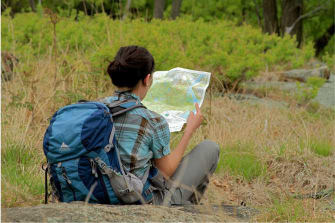
 Give $10 to support trails.
 December 31, 1969
 19:00 pm
Trip Reports
rate experience November 29, 2019
Very nice hike !
Did this hike today , 11/ 29/ 19. It was mostly sunny and cold in the upper 30's. This hike basically has everything; ups and downs to get your heart rate up , viewpoints and overlooks, multiple water crossings , varied terrain, shelters and even the historic hide out of a Revolutionary War criminal ! It is a fairly long hike and I should have started earlier than 10 am... I'm not a speed hiker so it took almost the full 6 hours Mr. Chazin estimates that it should. Got back to my car at 4 pm..close to dusk. Very clearly blazed trails but some very rough, eroded portions that are real tough on my old ankle injury.
June 13, 2016
Entrance to trail not clear
I walked this trail June 10, 2016. If you have never been on this trail before be careful to take the trail on the left when you enter the woods from Grove Rd. There is also a trail to the right that has a tree at the entrance with a red dot on white marking. It is easy to take the trail to the right which leads to the "O" Orange Trail. I did. I hiked several miles before realizing I was on the wrong trail. When I returned I saw others going straight for the correct trail so I assume they had walked the trail before. This was my first time.
Sadly the Dutch Doctor Shelter was littered with tin cans, food wrappers and empty bottles. I collected everything and put it in a bag but I wasn't able to carry it out. There was a large rattlesnake near the shelter, first time I'd seen one. Not a problem, just mentioning it. Besides these few glitches it was an enjoyable hike.
September 21, 2014
Group Hike Sept 2014
A group of us did the hike yesterday with a slight alteration to the route as I bought the map few years ago. (We've reached the Lake Skenonto and took the Blue Victory (Blue V) --> Ramapo Dunderberg (red-dot-on-white) back to the entrance, which yields 7.94 miles (from parking lot).
The markings were all very clear and the only minor detour we had was swtiching from TMI (red-dash-on-white) to White Bar. Mainly because we were expecting water in the Spring Brook. Unfortunately when we were there yesterday (09.20.14) the Brook was pretty dry and we stayed on TMI until we say White Bar Trail heading south. No biggie.
I love hiking this trail as it is accessible via Public Transportation, but definitely not for the faint of heart. Few of my friends are not in their best shape in terms of they don't walk on a regular basis, but with all the up hills with rocks were a bit of a challege. Nevertheless, we finished the trail a little under 5 hours. The shelter is in good shape for overnight hikers and I've also seen tents set up by Claudius Smith Den