Mountain bikes are allowed on nearly all trails in Blue Mountain Reservation, a Westchester County park, but the trails described in this hike are wide woods roads, allowing ample room for bicyclists to pass hikers. Bicyclists frequent the trails on weekends, so hikers may wish to visit the park on a weekday. Many of the park’s trails are rather poorly blazed, but they follow woods roads whose...
Hike Description:
Mountain bikes are allowed on nearly all trails in Blue Mountain Reservation, a Westchester County park, but the trails described in this hike are wide woods roads, allowing ample room for bicyclists to pass hikers. Bicyclists frequent the trails on weekends, so hikers may wish to visit the park on a weekday. Many of the park’s trails are rather poorly blazed, but they follow woods roads whose routes are clearly evident.
Most intersections are numbered on the park map, although (as of September 2014) few of these intersections are numbered on the ground. It is useful to be able to identify these intersections on the map, and for this reason, the numbers of the various intersections are included in this description. However, hikers should be aware that few intersections are actually marked by signposts, and no numbers are evident at most intersections. The free park map is essential to navigation in this park, which has a complex trail network. Thus, hikers should obtain a copy of the park map before beginning the hike.
From the entrance to the parking area, head uphill on a paved road. Just ahead, you’ll reach Intersection #1, marked by a triple-yellow blaze on a tree on the left. Bear left onto a yellow-blazed gravel road that heads to the northeast. At one point, the trail approaches the paved park road (opposite the Trail Lodge), but it curves right and reenters the woods, soon beginning to parallel a stream on the left.
At the next intersection (marked with the number “38" on a tree), turn left and cross the stream on a wide wooden bridge, then turn right and continue to parallel the stream, which is now on your right. At the following intersection (#36), turn right and recross the stream on another bridge, continuing to follow the yellow blazes. In another five minutes, you’ll reach Intersection #34 (marked with a small wooden marker on the west side of a large tree). Bear left here and follow an eroded red-blazed woods road uphill. (Intersection #34 is easy to miss; if you come to Intersection #38, you’ve gone too far and should retrace your steps.) As you follow this road, you’ll pass several “single-track” trails that leave to the right and left.
After passing a huge rock outcrop on the right, the woods road turns sharply right. A short distance beyond, you’ll reach Intersection #33. Bear left at the fork, continuing to follow the red blazes along a winding woods road, which eventually reaches the crest of the rise and begins to descend.
The red blazes end at a T-intersection (#31). Here, you should turn right onto a blue-blazed woods road. Follow this road for a short distance to Intersection #30 (marked by both a signpost and a number painted on a rock), then bear left and continue uphill on a white-blazed trail. At a sharp right turn on this trail, you’ll notice a yellow arrow on a tree that points to the left. Follow this arrow, which leads to a rock outcrop, just below the summit of Blue Mountain, with a view over the Hudson River. The mountains visible across the river are Dunderberg and Bear Mountains (the Perkins Memorial Tower can be seen on the left side of Bear Mountain). This is a good place to take a break. (There is no view from the actual summit of Blue Mountain.)
When you’re ready to continue, return to the white trail and retrace your steps (downhill) to Intersection #30. Turn left here and continue along the blue-blazed woods road. At the next fork (#29), bear right, continuing to follow the blue blazes. Soon, you’ll come to the route of a gas pipeline. After briefly following the pipeline, you’ll come to another fork (Intersection #27). Bear left, cross unpaved Montrose Station Road, and reenter the woods (passing Intersection #25, with the number painted on a rock). You’re now following the Briarcliff-Peekskill Trailway, marked by green diamond blazes, along a relatively level woods road (you’ll also notice a few blue blazes along the road).
At the next intersection (#21), bear left, continuing to follow the green diamond blazes along the woods road. After about ten minutes, you’ll reach a fork, with a huge fallen tree just ahead. (Just north of this junction, a metal “No Horseback Riders” sign has been enveloped by a tree!) Bear right and follow a wide stone-lined path uphill. After passing an abandoned stone cabin, you’ll come to a viewpoint from a rock outcrop at the summit of Mount Spitzenberg. The view from here is over Haverstraw Bay, with Hook Mountain beyond.
After taking in the view, retrace your steps to the junction with the main woods road, then turn left and follow the road back to Intersection #21. Bear left at the junction, and just ahead you’ll pass a huge boulder on the left, with several small trees growing out of cracks in the boulder. The woods road now heads downhill. At the next intersection (#20), turn right and begin to follow a white-blazed woods road (you can also follow a shortcut trail that bypasses this intersection).
In about a quarter mile, you’ll once again cross Montrose Station Road at Intersection #19 (the number is painted on a rock). After crossing a gas line, the woods road descends towards an unnamed pond. With the pond visible on the left, you’ll reach Intersection #12. Here, a purple-blazed trail continues ahead, but you should turn sharply left to continue on the white-blazed woods road, which proceeds around the pond in a clockwise direction. Just beyond Intersection #13 (marked by a metal sign enveloped by a tree), you’ll pass an interesting cracked rock on the right.
A short distance beyond the pond, you’ll come to Intersection #7, with the other end of the purple-blazed trail on the right. Continue ahead on the white-blazed woods road to the next intersection (#5). Here, you should bear left and soon begin to head downhill, now following blue, white and green diamond blazes. Continue ahead at Intersection #4 (marked by a signpost), where an orange-blazed trail begins on the left, and you’ll soon arrive back at the parking area where the hike began.
Publication: Submitted by Daniel Chazin on 09/07/2004 updated/verified on 09/12/2014


This loop hike climbs to two viewpoints over the Hudson River and passes an attractive pond.
41.271372, -73.928418
Westchester Co., NY
5 mi
3.5 hrs

Hike Checklist:
Whether you are going for a day hike or backpacking overnight, it is good practice to carry what we call The Hiking Essentials. These essentials will help you enjoy your outing more and will provide basic safety gear if needed. There may also be more essentials, depending on the season and your needs.
The Essentials
Hiking Shoes or Boots
Water - Two quarts per person is recommended in every season. Keep in mind that fluid loss is heightened in winter as well as summer. Don't put yourself in the position of having to end your hike early because you have run out of water.
Map - Know where you are and where you are going. Many of our hiking areas feature interconnecting network of trails. Use a waterproof/tear-resistant Tyvek Trail Conference map if available or enclose your map in a Ziplock plastic bag. If you have a mobile device, download Avenza’s free PDF Maps app and grab some GPS-enhanced Trail Conference maps (a backup Tyvek or paper version of the map is good to have just in case your batteries die or you don't have service). Check out some map-reading basics here.
Food - Snacks/lunch will keep you going as you burn energy walking or climbing. Nuts, seeds, and chocolate are favorites on the trail.
Sunscreen and insect repellent
Rain Gear and Extra Clothing - Rain happens. So does cold. Be prepared for changing weather. Avoid cotton--it traps water against your skin and is slow to dry. If you are wearing wet cotton and must return to your starting point, you risk getting chills that may lead to a dangerous hypothermia. Choose synthetic shirts, sweaters and/or vests and dress in layers for easy on and off.
Compass - A simple compass is all you need to orient you and your map to magnetic north.
Light - A flashlight or small, lightweight headlamp will be welcome gear if you find yourself still on the trail when darkness falls. Check the batteries before you start out and have extras in your pack.
First Aid Kit - Keep it simple, compact, and weatherproof. Know how to use the basic components.
Firestarter and Matches - In an emergency, you may need to keep yourself or someone else warm until help arrives. A firestarter (this could be as simple as leftover birthday candles that are kept inside a waterproof container) and matches (again, make sure to keep them in a waterproof container) could save a life.
Knife or Multi-tool - You may need to cut a piece of moleskin to put over a blister, repair a piece of broken equipment, or solve some other unexpected problem.
Emergency Numbers - Know the emergency numbers for the area you're going to and realize that in many locations--especially mountainous ones, your phone will not get reception.
Common Sense - Pay attention to your environment, your energy, and the condition of your companions. Has the weather turned rainy? Is daylight fading? Did you drink all your water? Did your companion fail to bring rain gear? Are you getting tired? Keep in mind that until you turn around you are (typically) only half-way to completing your hike--you must still get back to where you started from! (Exceptions are loop hikes.)
Check the weather forecast before you head out. Know the rules and regulations of the area.
The Leave No Trace Seven Principles
Plan Ahead and Prepare
- Know the regulations and special concerns for the area you'll visit.
- Prepare for extreme weather, hazards, and emergencies.
- Schedule your trip to avoid times of high use.
- Visit in small groups when possible. Consider splitting larger groups into smaller groups.
- Repackage food to minimize waste.
- Use a map and compass to eliminate the use of marking paint, rock cairns or flagging.
Travel and Camp on Durable Surfaces
- Durable surfaces include established trails and campsites, rock, gravel, dry grasses or snow.
- Protect riparian areas by camping at least 200 feet from lakes and streams.
- Good campsites are found, not made. Altering a site is not necessary.
- In popular areas:
- Concentrate use on existing trails and campsites.
- Walk single file in the middle of the trail, even when wet or muddy.
- Keep campsites small. Focus activity in areas where vegetation is absent.
- In pristine areas:
- Disperse use to prevent the creation of campsites and trails.
- Avoid places where impacts are just beginning.
- Pack it in, pack it out. Inspect your campsite and rest areas for trash or spilled foods. Pack out all trash, leftover food and litter.
- Deposit solid human waste in catholes dug 6 to 8 inches deep, at least 200 feet from water, camp and trails. Cover and disguise the cathole when finished.
- Pack out toilet paper and hygiene products.
- To wash yourself or your dishes, carry water 200 feet away from streams or lakes and use small amounts of biodegradable soap. Scatter strained dishwater.
- Preserve the past: examine, but do not touch cultural or historic structures and artifacts.
- Leave rocks, plants and other natural objects as you find them.
- Avoid introducing or transporting non-native species.
- Do not build structures, furniture, or dig trenches.
- Campfires can cause lasting impacts to the backcountry. Use a lightweight stove for cooking and enjoy a candle lantern for light.
- Where fires are permitted, use established fire rings, fire pans, or mound fires.
- Keep fires small. Only use sticks from the ground that can be broken by hand.
- Burn all wood and coals to ash, put out campfires completely, then scatter cool ashes.
- Observe wildlife from a distance. Do not follow or approach them.
- Never feed animals. Feeding wildlife damages their health, alters natural behaviors, and exposes them to predators and other dangers.
- Protect wildlife and your food by storing rations and trash securely.
- Control pets at all times, or leave them at home.
- Avoid wildlife during sensitive times: mating, nesting, raising young, or winter.
Be Considerate of Other Visitors
- Respect other visitors and protect the quality of their experience.
- Be courteous. Yield to other users on the trail.
- Step to the downhill side of the trail when encountering pack stock.
- Take breaks and camp away from trails and other visitors.
- Let nature's sounds prevail. Avoid loud voices and noises.
The Trail Conference is a 2015 Leave No Trace partner.
(c) Leave No Trace Center for Outdoor Ethics: www.LNT.org.
Directions to Trailhead :
From Route 9, take the Welcher Avenue exit and turn east away from the river. Follow Welcher Avenue for 0.4 mile to the park entrance (a parking fee - $5 for Westchester County residents with a Park Pass; $10 for non-residents is charged on weekends). Bear left beyond the tollbooth (following signs to Parking Area 3) and continue along the park road for 0.5 mile to a large parking area, passing the Trail Lodge along the way.
TRAIN TRANSPORT :
Not availableBUS TRANSPORT :
Not available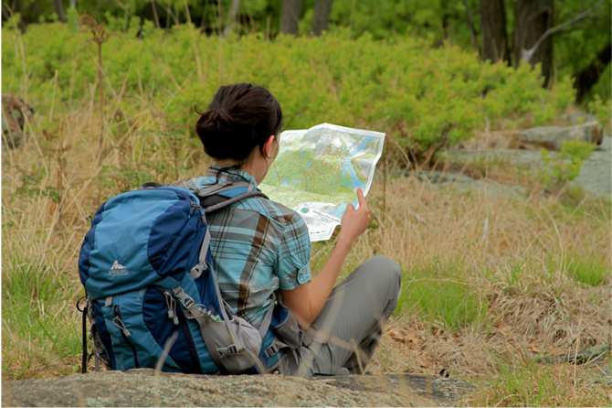
 Give $10 to support trails.
 December 31, 1969
 19:00 pm
Trip Reports
rate experience July 05, 2015
Awesome and Confusing
My family and I walked this loop, and we had a great time. This is a nice, peaceful trail for everyone. My 5 year old nephew really enjoyed all the little animals we saw! (Snakes, chipmunks, woodpeckers, a hawk and many many spiders) The only thing we did not enjoy was how poorly marked everything was! We tried to get to the top of the mountain but it was impossible to find the trail!
October 28, 2014
Marking of trails in Blue Mountain Reservation
I must say that when I recently revisited this park, I, too, was disappointed. As indicated in the description above, the trails in Blue Mountain Reservation are indeed poorly marked and poorly maintained. They are officially maintained by mountain bike groups, not by the Trail Conference. And most of the number markers at junctions are missing. I did succeed in following the hike, but only because I have a very good sense of how to follow a trail and how to figure out where you are, and because I carefully followed the park map (which itself leaves much to be desired). I cannot strongly recommend this hike -- many of the woods roads traversed by the route of the hike are eroded and not all that pleasant to walk on. But Blue Mountain Reservation is a large Westchester County park, so I felt that a hike in this park should be retained on the website.
October 28, 2014
Very disappointed!
I was so disappointed with this hike. There wasn't one trail marked with the proper color or number as described in Daniel's instructions. Easy to find yor way out, but I missed so much of the hike due to the poorly marked trail.